History of the 'Apostle' Roads
In August 2006 Matthew Pendleton, a local resident, produced a Character Appraisal for The Apostles to support an application for the area to become an Area of
Distinctive Quality. His report gives a good history and overview of the Apostles. Here is a summary:
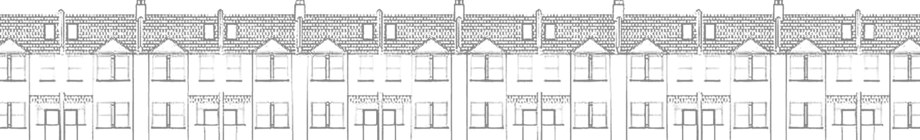
The Apostles are easily identifiable on maps as a dense area of development. The 12 roads are typically developed with single-family dwellings, of four habitable rooms. The two-bedroom design that
forms almost all the houses is the smallest family house available in the area.
The origins, development and architectural character of the area
The Apostles area was known originally as the Bushey Mead Estate, and development commenced circa 1890, according to E M Jowlett writing in “Raynes Park with West Barnes & Cannon Hill – A Social
History”, and houses in Chestnut Road, Bronson, Sydney and Dupont Roads had been started by 1901 (63 Bronson Road is dated 1898); Dorien Road was added in 1902; Vernon Road, formerly known as Savoy
Road, Edna Road and Prince George’s Avenue were under way in 1904; Aston Road, Carlton Park Avenue had houses by 1905; Clifton Park Avenue began in 1906, and the final road, Gore Road was under
construction by 1907.
Extension of some roads, southwards, took place soon after the first phase of development was completed. Houses at the original end of Carlton Park Avenue have first floor oriel windows that would
once have looked out across Prince George’s Playing Fields, but now face the end wall of the adjacent short terraces of six houses. Development of the Apostles area was effectively complete by
1920.
Most roads are architecturally cohesive, with limited stylistic variation from one end to the other. All the roads have houses of two storeys in height with clay tile-capped party parapet walls above
the roof line. Roofs were originally either of natural blue-grey slate or clay plain tiles. The vast majority of houses retain their chimney stacks and clay pots which make a strong positive
contribution to the appearance of the streets, especially when seen from the slopes of Wimbledon Hill to the north, and from Prince George’s Playing Fields to the south. Sash windows predominate,
with some later Edwardian houses having casements which sometimes still have coloured leaded lights.
Houses in Carlton Park Avenue are noteworthy for their use of renaissance-style stucco motifs, elaborate bargeboards, and egg-and-dart string courses. Edna Road has houses with rendered and stuccoed
details including a simple art nouveau theme. Some houses retain leaded light windows and the style of the road anticipates the suburban Tudor revival style of the 1920’s & 30’s. The far south
end of Edna Road has a short row of terraced houses with unusual porch details. No. 83 is particularly noteworthy.
Second World War bombing destroyed housing at the northern ends of Carlton Park Avenue, Vernon Avenue, Dupont Road and Sydney Road. These were rebuilt in the 1950’s in red brick. Although lower in
height than their predecessors they make an interesting contribution to the character of the area and demonstrate the continuing evolution of the terraced house form.
Chestnut Road, the first of the 12 roads to be developed appears on the 1894 Ordnance Survey, and has the greatest variety of houses. The northern half is mostly late Victorian semi-detached villas,
with the eastern side being punctuated by a group of 1920’s semi-detached houses
Community facilities originally included a school and public bath house in Approach Road/Aston Road, a political club in Prince George’s Avenue, Bushey Mead Hall in Dorien Road, and a
Salvation Army Hall in Sydney Road. The school made way for a library, which has been redeveloped in 2005 to include the site of the public wash house, and Bushey Mead Hall has been replaced with
housing.
Archaeological significance
Prior to development circa 1900, most of the area now covered by housing was last used as a cricket ground, covering a little over 48 acres, according to the 1894 Ordnance Survey. The 1871 OS shows
fields of various sizes. The nearest identified site of archaeological importance is Cannon Hill which lies about half a mile due south of the Apostles. Recent building work on land behind Sydney and
Dupont Roads has revealed the presence of an early 20th Century rubbish tip, which has yielded numerous bottles and stoneware items of Victorian and Edwardian date.
Prevalent building materials, textures and colours.
The majority of the older houses were built of buff-coloured London stock brick with slate roofs. Later houses include pebble-dashing and decorative stucco work. A section at the north end of Sydney
and Dupont Roads was rebuilt in the post war period, following serious damage caused by bombing in 1944.
Recent building work has respected the traditional pattern, thus the area is a cohesive representative cross-section of terraced house development spanning 100 years.
The semi-detached villas on Chestnut Road, amongst the first houses to be built, exhibit typical Victorian detailing with carved stone spandrels and capitals. The early terraced houses, typified by
those in Aston Road, display classically inspired detailing with simple ornamentation such as timbered gables, and glazed and panelled front doors.
Buff London stock brick prevails as the material of choice for walling, except on the commercial buildings to Approach Road/Kingston Road where pressed red brick is characteristic. Decorative
elements vary in form, from simple classical details as seen in Aston Road, to the more expressive stucco work seen in Prince George’s Avenue and Carlton Park Avenue.
Roofs were originally of blue-grey Welsh slate or red clay plain tiles. Many roofs have been replaced in the latter decades of the twentieth century with concrete tiles of red-brown colour. Where
hipped gables are used these are typically detailed with lead covered hiprolls or red clay tiles contrasting with the slate. Because of the inherent unsuitability of this roof form for recovering
with concrete interlocking tiles, the vast majority of such roofs are still slate covered. Gabled roofs were originally finished with ornamental finials; however there are few remaining either whole
or in part.
Chimney stacks play a significant role in enlivening the roofscape and are intact on all but a very small number of properties. The majority of these stacks also retain their original clay pots. The
pattern of stack design is generally consistent throughout the area.
Commercial buildings have more elaborate chimney stacks designed to ornament the building and to be seen against the sky. This is particularly evident when seen from the raised vantage point of
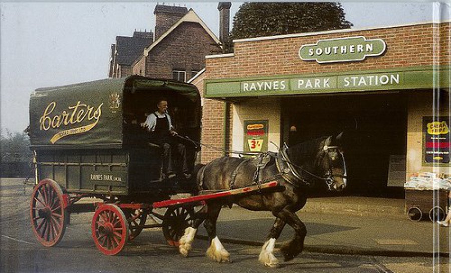
Raynes Park railway station and is also appreciable from Prince George’s Playing Fields.
The prevalent housing plan form is of three rooms on the ground floor and three rooms at first floor level. The houses were originally built without bathrooms, thus there is no ‘closet wing’ on the
back of most houses. The only projection from otherwise flush façades is a two storey bay window at the front and a single storey outside WC compartment attached to the back of each house. Exceptions
include a group of houses at the north-eastern end of Dorien Road, and the late Victorian semi detached houses in Chestnut Road.
Original windows and doors make a strong contribution to the character of the streets. Many original doors can still be seen in Edna Road where there are still some good examples of coloured leaded
lights. Few original front paths remain, where still in situ they tend to be in poor condition but add colour and interest. Examples range from simple buff and red diamond patterns to more
complicated geometrical arrangements of tessellated work, typically black and white with occasional use of coloured tiles for further decorative effect.
The contribution made by front gardens, trees, hedges, walls etc.
Many boundary walls have been rebuilt in a variety of brick and blockwork, following removal of railings in the 1940’s, although there are instances of timber fencing with timber pedestrian gates,
supported by concrete posts. In Carlton Park Avenue, this appears from contemporary postcard images to have been the original pattern in this street, however there do not appear to be any surviving
original examples. There are some new examples of metal railings on brick walls, and they make a positive contribution to the character of the area. The roads are of a consistent width, and some have
granite sett gutters. All roads have wide granite kerbstones, with the Kingston and Approach road pavements having a mix of concrete paving slabs and grey brick panels. Vehicle crossovers are limited
in number since the small front gardens give little opportunity for parking.
The tree-lined streets are all on a north to south alignment, and only those at the eastern side of the area have alleyways at the rear. The terraces are set back from the pavement line forming small
gardens, enclosed originally by low walls with railings and now by a variety of walls, fences and hedges.
The street trees and green spaces are a substantial asset to the area, and are an important characteristic. They contribute significantly to the character and appearance of the local area, providing
a soft landscape edge within the urban landscape and bring environmental benefits.
The rows of trees form part of the historic planting scheme of the Apostles. Lime trees were amongst the first to be planted and are uniformly pollarded so that their overall height is not normally
greater than that of the houses, making for a distinctive townscape. Currently, the selection of trees is mixed, not all species are suitable, and many specimens need to be replaced.
The area has no public open space and is heavily reliant on the use of the planted sections of the Bushey Road verge, managed by the Council and the London Wildlife Trust, Prince George’s
Playing Fields, and Cannon Hill Common which is approximately half a mile distant.
More History
A CHRONOLOGY OF THE APOSTLES
COLLECTIVELY NAMED BY VISITING DISTRICT NURSES TO IDENTIFY THE ESTATE.
EACH ROAD WAS LENGTHENED OVER TIME, BELOW IS ORIGINAL CONSTRUCTION DATE WITH HOUSES BUILT IN THE INITIAL PERIOD.
1890 - NEPEAN TERRACE WAS THE START POINT WITH 5 HOUSES AND THEN DEVELOPED INTO
1901 – CHESTNUT ROAD (25)
1901 – BRONSON ROAD (No’s 1-47 + 2-60)
1901 – SYDNEY ROAD (49)
1901 – DUPONT ROAD (71) (No’s 1-71 + 2-34)
1902 - DORIEN ROAD (5)
1903 – SAVOY ROAD (LATER RENAMED VERNON)
1903 – EDNA ROAD
1903 - PRINCE GEORGES AVENUE (6) LENGTHENED 1906 (No’s 27-50)
1905 – ASTON ROAD (No’s 2-36 + 1-41)
1905 - CARLTON PARK AVENUE (No’s 1-4)
1906 – CLIFTON PARK AVENUE
1907 – GORE ROAD (8)
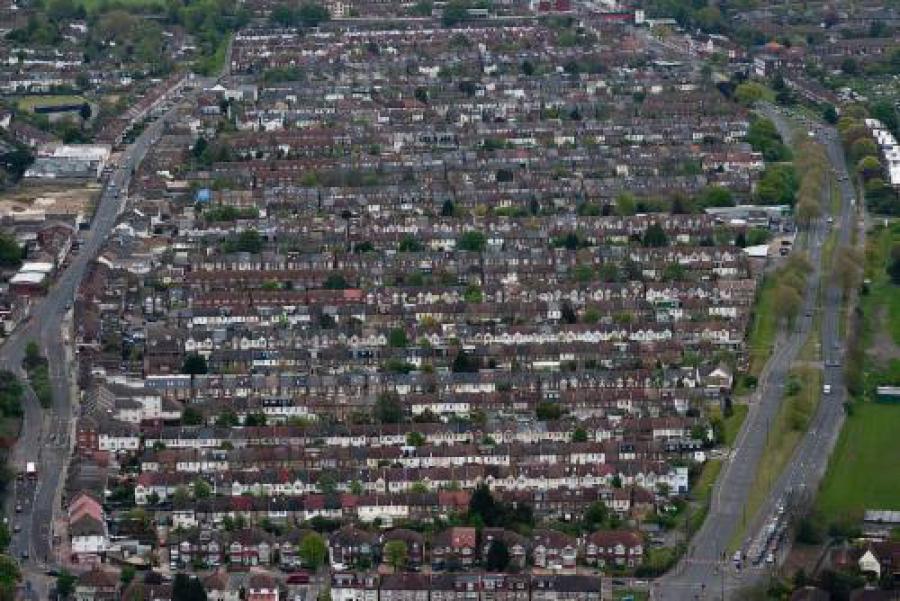
Aerial View of The Apostles copyright Pete Latham. See more of his excellent photos at flickr.com

Prince George’s Playing Fields. Date unknown but original changing rooms in the distance and probably built during WW2 era when site was an anti-aircraft battery.
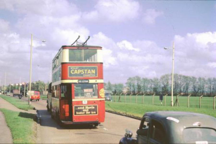
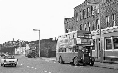
Trolleybus being towed along Bushey Road after the closure of the system.

The Junction Tavern Route 77C introduced in 1959 on Sundays to replace the 77A and ready to head off on it’s lengthy journey to King’s Cross. It ran between there and Raynes Park via Euston, Russell Square, Aldwych, Trafalgar Square, Whitehall, Westminster Bridge, Vauxhall, Wandsworth Road, Clapham Junction, Wandsworth, Wimbledon Park and Wimbledon. Bus stop is outside The Junction Tavern (now The Railhouse) with the old iron Skew Arch behind. The arch operated as a single lane road beneath with traffic lights at either end.
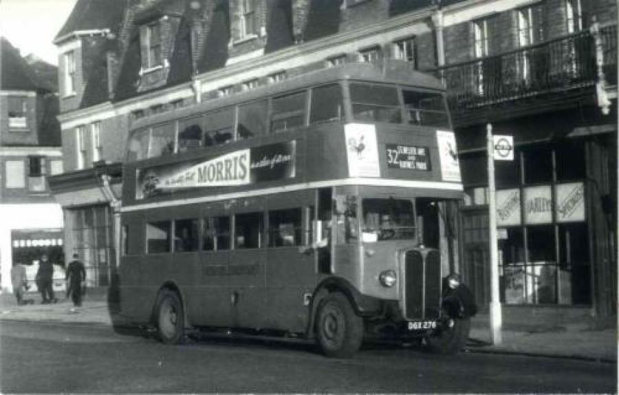
The number 32 bus pictured in 1951, St. Helier Avenue to Raynes Park and parked up outside R.C. Farley & Co (bedding specialists). Ornate iron verandas seen in earlier photo still in evidence.
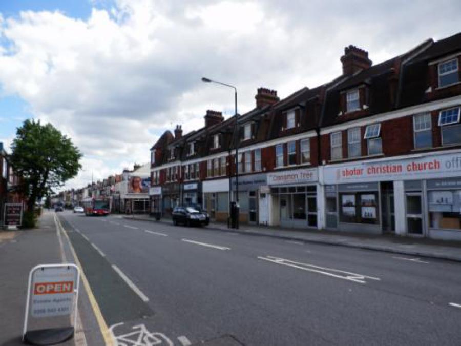
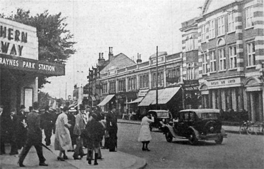
THEN: Looking east along Kingston Road from Carlton Park Avenue, with Vernon Avenue being the first road visible.
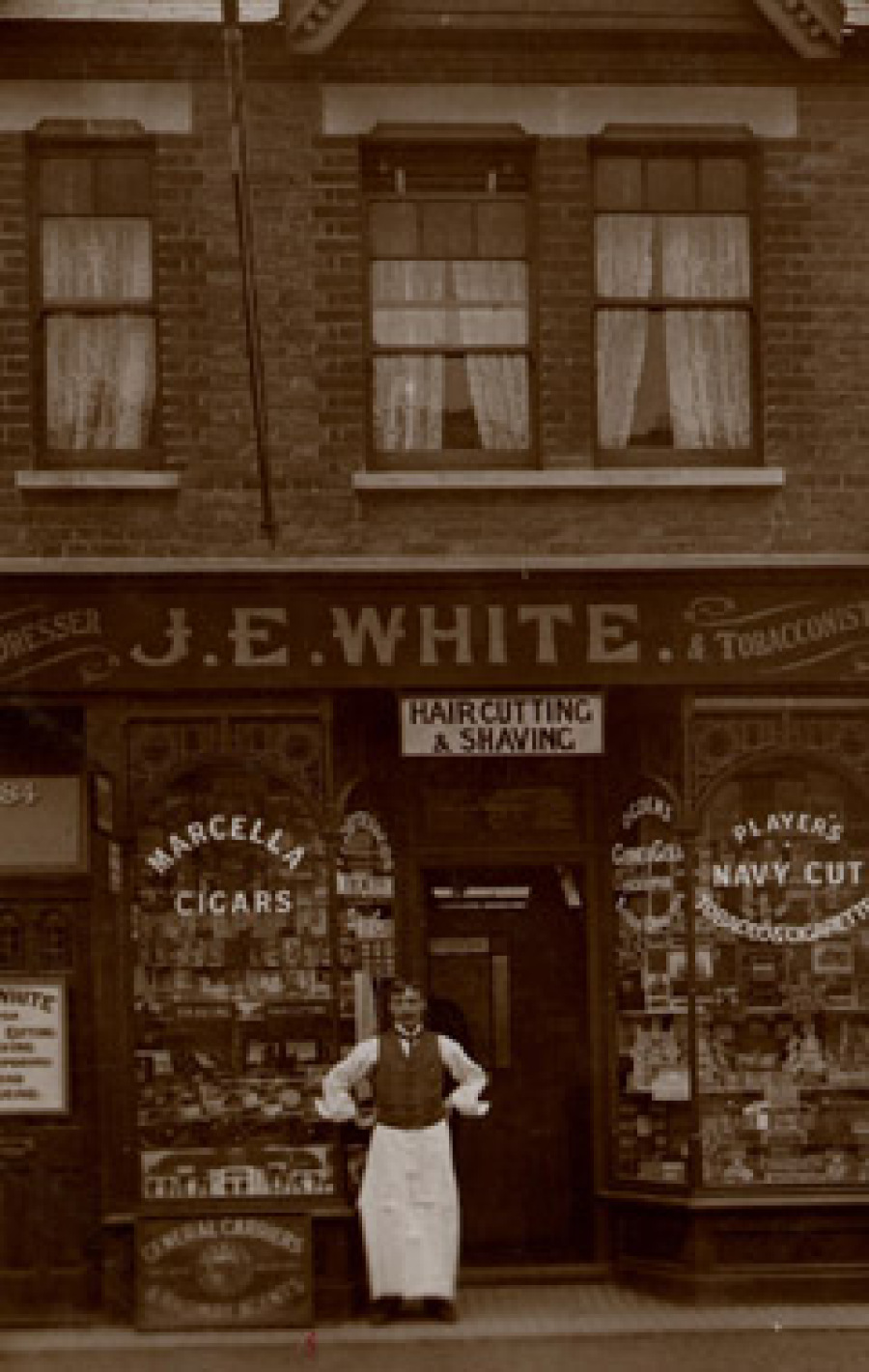
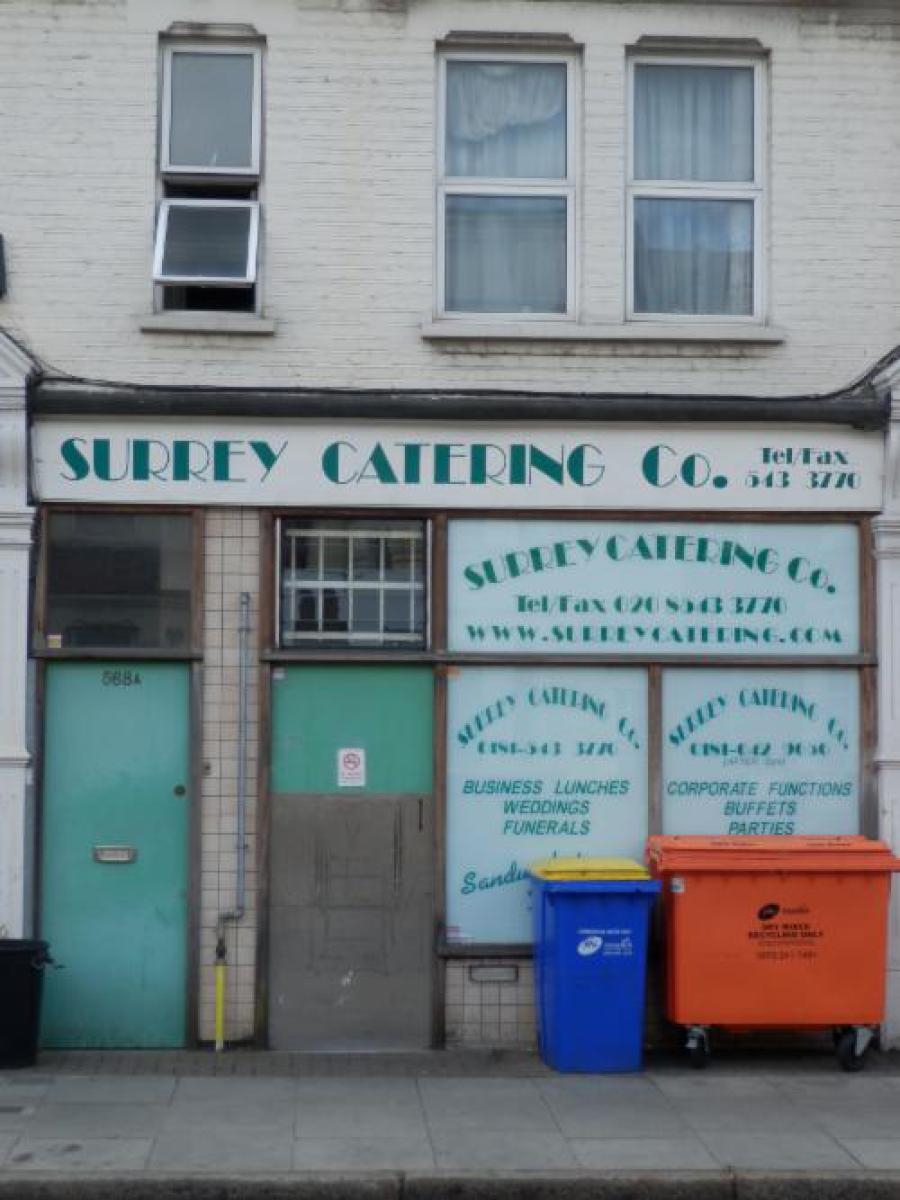
Number 484 Kingston Road circa 1909 and today (re-numbered 568). Mr John Emerson White, hairdresser and tobacconist stands proudly outside his shop.
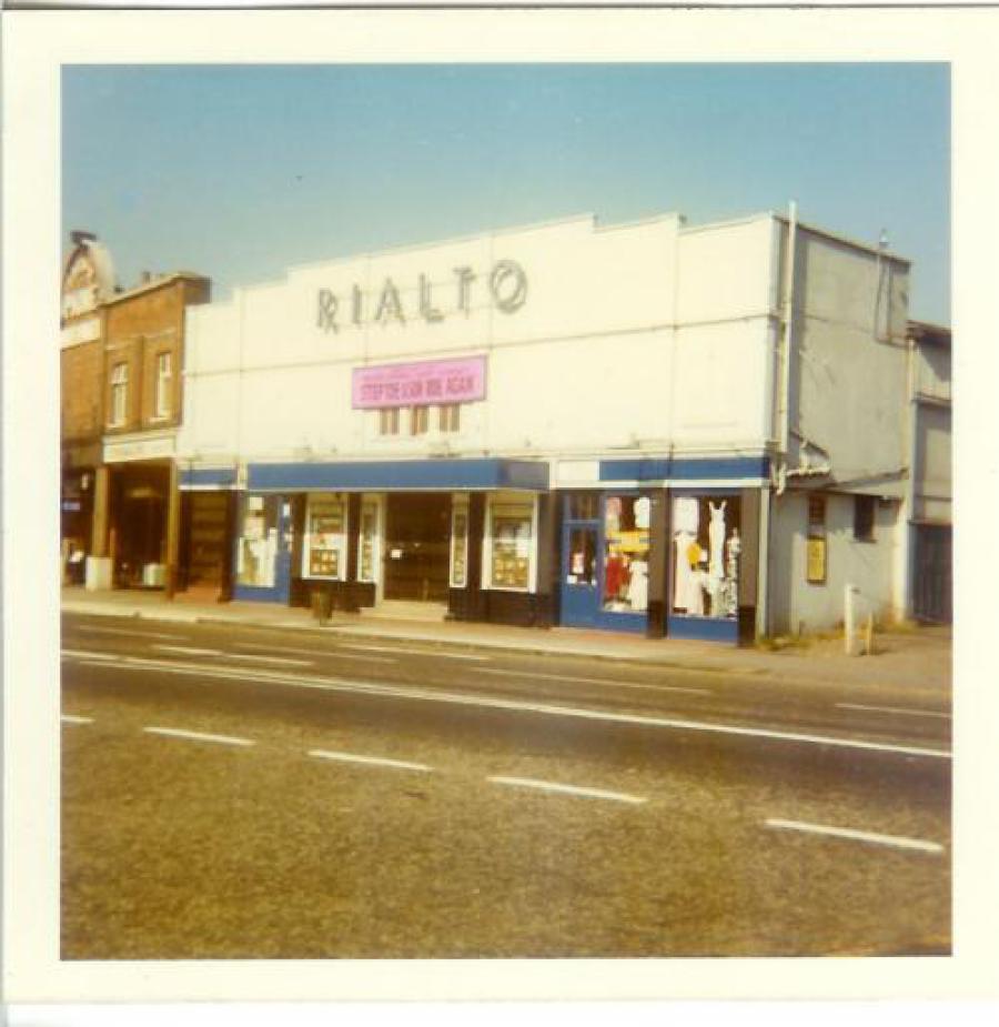
Our Local Cinema: The much loved Rialto cinema in Raynes Park. Programme for 1921, black & white picture from 1934 and colour from 1973. The cinema was demolished in 1978 (last film The Swarm) and replaced by the nondescript office block St. George’s House.

York Terrace no longer in name but still retaining its Edwardian attributes.
1939
1950
The Apostles Residents Association
The Apostles Association (ARA) was set up in 1988. It was set up with the encouragement of our then local ward councillor, John Elvidge (now Chair of the Raynes Park
& West Barnes Residents Association). John had become aware that there was no local organisation to consult over local planning applications. As ward councillor, he had to handle the application
from David Lloyd to build on part of Prince George’s Playing Fields. There were two local issues at the time which encouraged us to form a residents’ association. The first was the plot of land
between Sydney and Dupont Roads. Chris Wilson (resident of Dupont Road) had set up an association of the two roads to try and get some plans drawn up for the sensible use of that space. At the time
much of it had become derelict and a dumping ground for fly tippers. The other issue which had starting affecting all the Apostle roads was the threat of our small homes being turned into two flats.
Developers had become wise to the fact that two flats would sell for quite a bit more than one unit. We had visions of our streets gradually being converted into small flats. We believed that this
would have destroyed the particular nature of our streets, as well as creating other problems such as parking.
It was in this context that it was decided to form the ARA. Many people flocked from all of the streets to the meeting rooms at the library. And so we were launched.
In terms of the Sydney-Dupont land, there were proposals to install a community garden and some funding had been identified. Negotiations appeared to be going well with the land owner. Then suddenly
he put in a planning application for 4 bungalows. Surprisingly the Planning Inspector overturned the Council’s refusal to grant planning permission.
In terms of flat conversions, various submissions have been made to the Council to make sure the Borough Plan does not allow such developments in our streets. Whilst a few houses were indeed turned
into flats, we managed to make sure the Borough Plan was so worded as to prevent any more such conversions taking place.
Over the 30 years, the ARA was worked quietly in the background, examining and challenging local planning applications, and campaigning for anything which may improve our local environment.